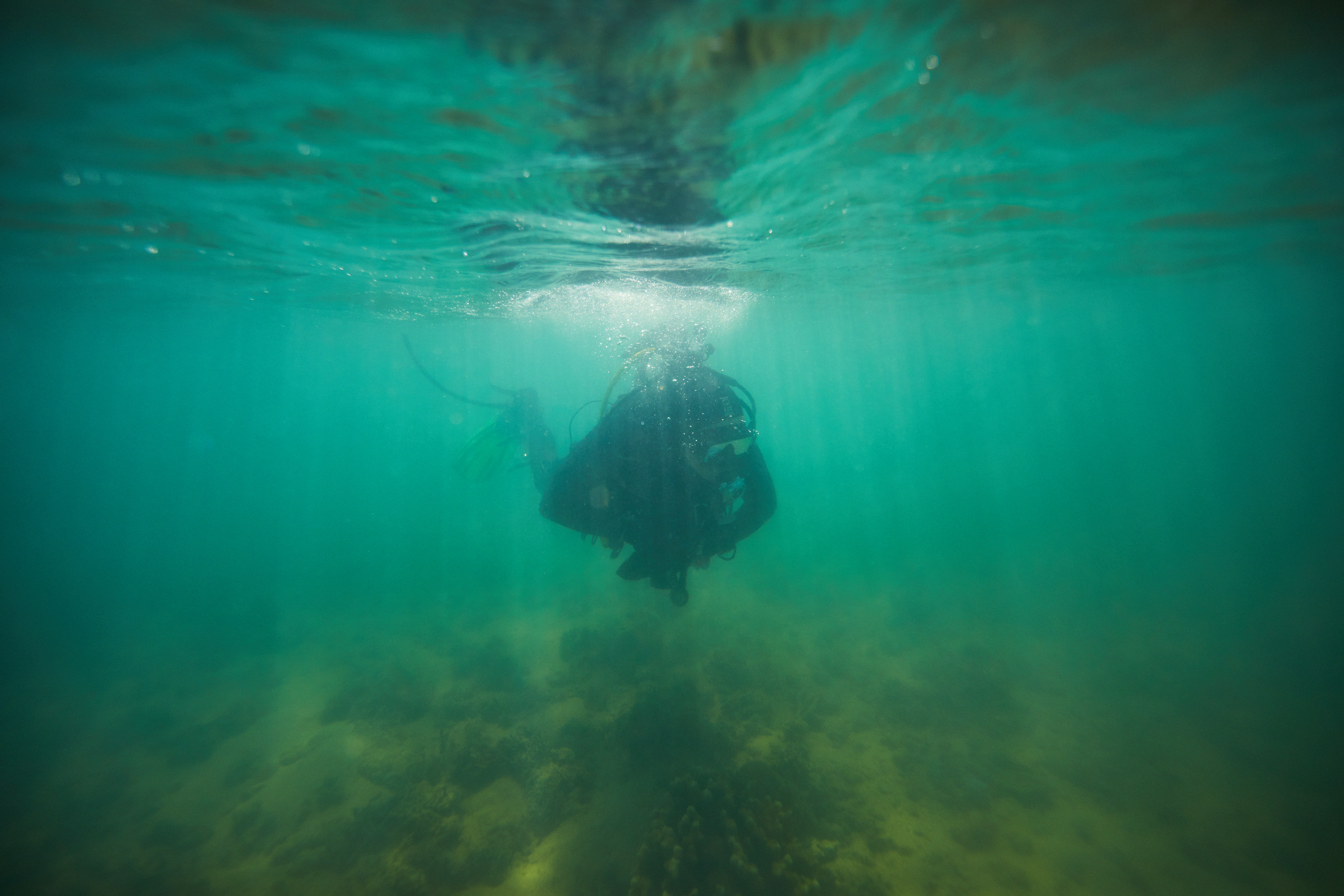
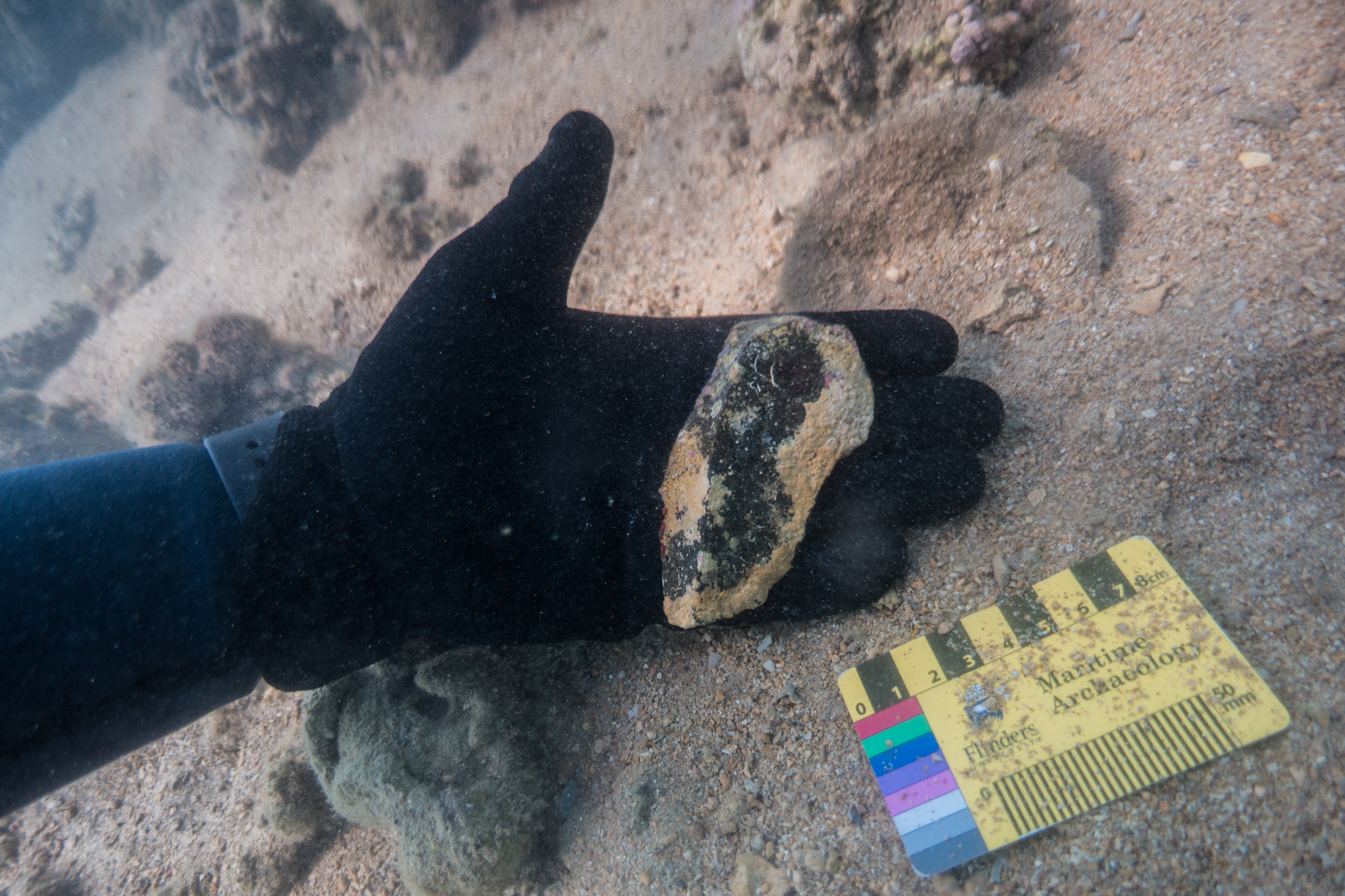
This study investigates the hydrodynamic processes that affect site formation of a submerged lithic scatter located at Cape Bruguieres Channel (CBC) in the NW of Western Australia through a combination of in situ, experimental and modelling approaches. A pressure sensor and current meter were deployed on the site and recorded hydrodynamic data over a three month period with maximum current speeds of 0.55 m/s recorded during spring tides. To test the potential for artefacts to be transported away from their original depositional context, a representative selection of submerged archaeological artefacts collected from the site and natural stone were subjected to a range of current speeds within a controlled flume environment. This demonstrated that all artefacts and natural stone remained stable within the flume even when experiencing current speeds approaching the maximum current velocities recorded at the site, regardless of lithic orientation relative to the current direction. In addition it was seen that mass alone did not control the hydrodynamic stability of the lithics tested, rather the hydrodynamic properties of a lithic are highly dependent on both its shape and orientation relative to current flow direction. This is a significant finding and suggests that the smaller the mass of a lithic does not necessarily correspond with preferential transport by currents caused by tides or waves. To test the potential for lithics to be transported during extreme cyclone events, a fine 30 m resolution bathymetric grid was constructed for CBC and current speeds modelled for Tropical Cyclone (TC) Damien which crossed the archipelago as a Category 3 (severe tropical cyclone) in February 2020. Modelled currents during this event reached a maximum velocity of 0.8 m/s and would be capable of transporting the smallest mass lithic but only if it was orientated in its most hydrodynamically unstable position relative to the current direction. These results suggest the Cape Bruguieres lithic scatter site has effectively remained in situ following sea level inundation at approximately 7,000 years BP.
During the past 20,000 years approximately one-quarter of the continental landmass of Australia was inundated by postglacial sea-level rise, submerging archaeological evidence for use of these landscapes. Underwater archaeological sites can offer substantial insights into past lifeways and adaptations to rapidly changing environments, however the vast scale of inundation presents a range of challenges in discovering such sites. Here we present a suite of methods as a model methodology for locating sites in submerged landscapes. Priority areas for survey were based on palaeoenvironmental contexts determined from the onshore archaeological record. Remote sensing was used to identify seabed composition and indicators of palaeolandscapes where high potential for human occupation and site preservation could be identified in Murujuga (or the Dampier Archipelago), northwestern Australia. Target locations were surveyed by scientific divers to test for the presence of archaeological material. Application of this methodology resulted in the discovery of the first two confirmed sub-tidal ancient Aboriginal archaeological sites on Australia’s continental shelf. Survey methods are discussed for their combined value to identify different classes of landscapes and archaeological features to support future underwater site prospection.
New article by Wiseman et al. published in Quaternary International (Photo: S. Wright)
We report Australia’s first confirmed ancient underwater archaeological sites from the continental shelf, located off the Murujuga coastline in north-western Australia. Details on two underwater sites are reported: Cape Bruguieres, comprising > 260 recorded lithic artefacts at depths down to −2.4 m below sea level, and Flying Foam Passage where the find spot is associated with a submerged freshwater spring at −14 m.
The DHSC project team recognises the Murujuga Aboriginal Corporation Council of Elders and Murujuga Land and Sea Rangers Unit as core collaborators on this project.
The DHSC project was supported by the Australian Research Council, Flinders University and the Hackett Foundation. We thank our many colleagues, volunteers, and friends of the project including Ken Mulvaney, Shakti Chakravarty, Victoria Anderson, Sarah de Koning, Hiro Yoshida, Kerry Ludwig, Mads Holst, Sam Wright, Annette George, Tom Allardyce and Graham and Michelle Evans and the AustMarine staff for their support throughout the DHSC project. Further thanks to EGS Surveys and the Pilbara Ports Authority for supplying additional survey data.
Link to the full article published in the Public Libarary of Science (PLOS ONE):
Deep History of Sea Country: Climate Sea level and Culture
Funded by Australian Research Council (Discovery Project DP170100812)
Submerged landscape archaeology is an under-researched field in Australia and represents a major opportunity to address knowledge gaps in world prehistory such as early human migrations, the archaeology of land bridges and coastal-hinterland cultural exchange.